
bool(false)

bool(true)

bool(true)

int(0)
Staten Island, NY 10301
Foreclosure History
Lis Pendens
Property details
The description and property data below may have been provided by a third party, the homeowner or public records.
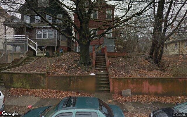
44 Taft Ave, Staten Island, NY 10301 is a Multi Family Home built in 1901. This property currently has an estimated value of $775,300. According to the Staten Island public records, the property at 44 Taft Ave, Staten Island, NY 10301 has approximately 1,808 square feet, with a lot size of 3,700 square feet. Nearby schools include Ps 31 William T Davis, Fort Hill Collaborative Elementary, Ps 16 John J Driscoll and Ps 373.
Primary Land Use and Tax Lot Information
for 44 Taft Ave

Property Tax History
for 44 Taft Ave
| Year | Taxes | |
|---|---|---|
| 2023 | $4,780 | $37,020 |
| 2022 | $4,434 | $30,120 |
Sold Homes
near 44 Taft Ave
| Address | Price | Beds | Baths |
|---|---|---|---|
|
Staten Island, NY 10301MF
|
$650,000
01/23/2025
|
6
|
2
|
|
Staten Island, NY 10301MF
|
$515,000
12/12/2024
|
4
|
3
|
|
Staten Island, NY 10301MF
|
$565,000
11/22/2024
|
2
|
1
|
|
Staten Island, NY 10301MF
|
$949,000
01/07/2025
|
3
|
4
|
|
Staten Island, NY 10301MF
|
$420,000
11/27/2024
|
4
|
2
|
Homes For Sale
near 44 Taft Ave
| Address | Price | Beds | Baths |
|---|---|---|---|
|
Staten Island, NY 10310MF
|
$539,000
373 days ago
|
5
|
2
|
|
Staten Island, NY 10301MF
|
$669,999
304 days ago
|
6
|
2
|
|
Staten Island, NY 10301MF
|
$678,888
154 days ago
|
7
|
3
|
|
Staten Island, NY 10310MF
|
$939,000
120 days ago
|
3
|
1
|
|
Staten Island, NY 10301MF
|
$850,000
91 days ago
|
8
|
5
|
Home Value
for 44 Taft Ave
Estimated values are not a substitute for professional expertise. Contact your RE agent for a market assessment.
Schools
serving 44 Taft Ave
| School Name | Rating |
|---|---|
|
55 Layton Avenue, Staten Island, NY 10301
|
4 / 10 |
|
101 Warren Street, Staten Island, NY 10304
|
4 / 10 |
|
195 Daniel Low Terrace, Staten Island, NY 10301
|
3 / 10 |
Data provided by
GreatSchools.org © 2025. All Rights Reserved.
School service boundaries are intended to be used as reference only.
To verify enrollment eligibility for a property, contact the school directly.
Flood Factor
for 44 Taft Ave
1
|10
Minimal

FEMA Zone (Est.)
X (unshaded)
Flood insurance:
Recommended
Flood risks are increasing as sea levels rise and weather patterns change.
This property has a
Minimal Flood Factor
.
Although flood risks across the country are changing because of the environment, this property is unlikely to flood over the next 30 years.
Although flood risks across the country are changing because of the environment, this property is unlikely to flood over the next 30 years.
Flood Factor data provided by FloodFactor.