
bool(false)

bool(true)

bool(true)

int(0)
Staten Island, NY 10303
Foreclosure History
Property details
The description and property data below may have been provided by a third party, the homeowner or public records.
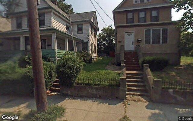
217 Morningstar Rd, Staten Island, NY 10303 is a Multi Family Home built in 1920. This property was last sold for $131,500 in 2000 and currently has an estimated value of $806,900. According to the Staten Island public records, the property at 217 Morningstar Rd, Staten Island, NY 10303 has approximately 1,966 square feet, with a lot size of 5,000 square feet. Nearby schools include Ps 21 Margaret Emery Elm Park, Ps 44 Thomas C Brown, Port Richmond School For Visionary, New World Preparatory Charter School and Staten Island School Of Civic Leadership.
Primary Land Use and Tax Lot Information
for 217 Morningstar Rd

Property Price History
for 217 Morningstar Rd
| Date | Event | Price | ||
|---|---|---|---|---|
| Mar 8, 2000 | Sold | $131,500 | $67 | Public Record |
Property Tax History
for 217 Morningstar Rd
| Year | Taxes | |
|---|---|---|
| 2023 | $4,961 | $38,820 |
| 2022 | $4,601 | $31,560 |
Sold Homes
near 217 Morningstar Rd
| Address | Price | Beds | Baths |
|---|---|---|---|
|
Staten Island, NY 10302MF
|
$890,000
01/09/2025
|
3
|
2
|
|
Staten Island, NY 10302MF
|
$771,000
03/31/2025
|
4
|
2
|
|
Staten Island, NY 10310MF
|
$592,800
12/27/2024
|
2
|
3
|
|
Staten Island, NY 10303MF
|
$630,000
01/16/2025
|
3
|
2
|
|
Staten Island, NY 10314MF
|
$720,000
10/29/2024
|
4
|
3
|
Homes For Sale
near 217 Morningstar Rd
| Address | Price | Beds | Baths |
|---|---|---|---|
|
Staten Island, NY 10314MF
|
$930,000
162 days ago
|
4
|
3
|
|
Staten Island, NY 10314MF
|
$899,000
25 days ago
|
4
|
3
|
|
Staten Island, NY 10310MF
|
$849,000
7 days ago
|
3
|
3
|
|
Staten Island, NY 10310MF
|
$659,000
25 days ago
|
2
|
2
|
|
Staten Island, NY 10310MF
|
$949,000
20 days ago
|
4
|
2
|
Home Value
for 217 Morningstar Rd
Estimated values are not a substitute for professional expertise. Contact your RE agent for a market assessment.
Schools
serving 217 Morningstar Rd
| School Name | Rating |
|---|---|
|
168 Hooker Place, Staten Island, NY 10302
|
6 / 10 |
|
355 Morningstar Road, Staten Island, NY 10303
|
— |
|
80 Maple Parkway, Staten Island, NY 10303
|
4 / 10 |
Data provided by
GreatSchools.org © 2025. All Rights Reserved.
School service boundaries are intended to be used as reference only.
To verify enrollment eligibility for a property, contact the school directly.
Flood Factor
for 217 Morningstar Rd
1
|10
Minimal

FEMA Zone (Est.)
X (unshaded)
Flood insurance:
Recommended
Flood risks are increasing as sea levels rise and weather patterns change.
This property has a
Minimal Flood Factor
.
Although flood risks across the country are changing because of the environment, this property is unlikely to flood over the next 30 years.
Although flood risks across the country are changing because of the environment, this property is unlikely to flood over the next 30 years.
Flood Factor data provided by FloodFactor.