
bool(false)

bool(true)

bool(true)

int(0)
Queens Village, NY 11429
Foreclosure History
Property details
The description and property data below may have been provided by a third party, the homeowner or public records.
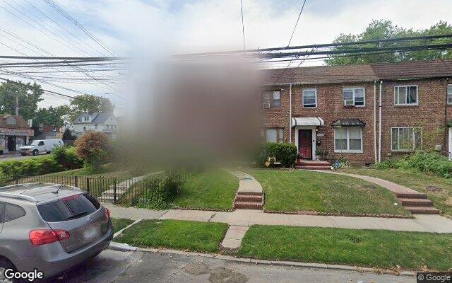
113-56 212th St, Queens Village, NY 11429 is a Single Family Home built in 1950. This property currently has an estimated value of $509,300. According to the Queens Village public records, the property at 113-56 212th St, Queens Village, NY 11429 has approximately 1,224 square feet, with a lot size of 1,530 square feet. Nearby schools include Ps Ms 147 Ronald Mcnair, Ps 136 Roy Wilkins and Ps 34 John Harvard.
Primary Land Use and Tax Lot Information
for 113-56 212th St

Property Tax History
for 113-56 212th St
| Year | Taxes | |
|---|---|---|
| 2023 | $5,319 | $41,220 |
| 2022 | $4,932 | $34,320 |
Sold Homes
near 113-56 212th St
| Address | Price | Beds | Baths |
|---|---|---|---|
|
Queens Village, NY 11429SF
|
$630,000
01/10/2025
|
3
|
2
|
|
Queens Village, NY 11429SF
|
$728,000
12/13/2024
|
3
|
3
|
|
Cambria Heights, NY 11411SF
|
$336,333
12/11/2024
|
3
|
1
|
|
Queens Village, NY 11429SF
|
$895,000
12/19/2024
|
4
|
4
|
|
Saint Albans, NY 11412SF
|
$470,000
04/16/2025
|
3
|
2
|
Homes For Sale
near 113-56 212th St
| Address | Price | Beds | Baths |
|---|---|---|---|
|
Cambria Heights, NY 11411SF
|
$749,000
30 days ago
|
3
|
2
|
|
Elmont, NY 11003SF
|
$849,000
32 days ago
|
4
|
3
|
|
Cambria Heights, NY 11411SF
|
$789,999
31 days ago
|
4
|
3
|
|
Bellerose, NY 11426SF
|
$780,000
7 days ago
|
3
|
3
|
|
Saint Albans, NY 11412SF
|
$625,000
9 days ago
|
3
|
2
|
Home Value
for 113-56 212th St
Estimated values are not a substitute for professional expertise. Contact your RE agent for a market assessment.
Schools
serving 113-56 212th St
| School Name | Rating |
|---|---|
|
11315 SPRINGFIELD BLVD, Queens, NY 11429
|
— |
|
11218 SPRINGFIELD BLVD, Queens, NY 11429
|
— |
|
218-01 116TH AVE, Queens, NY 11411
|
3 / 10 |
Data provided by
GreatSchools.org © 2025. All Rights Reserved.
School service boundaries are intended to be used as reference only.
To verify enrollment eligibility for a property, contact the school directly.
Flood Factor
for 113-56 212th St
1
|10
Minimal

FEMA Zone (Est.)
X (unshaded)
Flood insurance:
Recommended
Flood risks are increasing as sea levels rise and weather patterns change.
This property has a
Minimal Flood Factor
.
Although flood risks across the country are changing because of the environment, this property is unlikely to flood over the next 30 years.
Although flood risks across the country are changing because of the environment, this property is unlikely to flood over the next 30 years.
Flood Factor data provided by FloodFactor.