545 E 89th St, Brooklyn, NY 11236 Kings County Last Updated: July 12, 2023
Pre-Foreclosure: Lis Pendens, Estimated Market Value $1,061,100
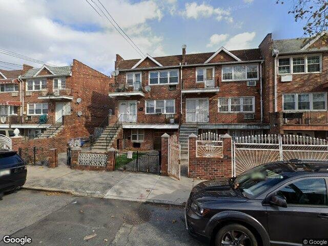
Description: 545 E 89th St, Brooklyn, NY 11236 is a Multi Family Home built in 1970. This property was last sold for $675,000 in 2006 and currently has an estimated value of $1,061,100. According to the Brooklyn public records, the property at 545 E 89th St, Brooklyn, NY 11236 has approximately 2,970 square feet, with a lot size of 3,041 square feet. Nearby schools include Ps 114 Ryder Elementary School, Explore Excel Charter School and Ps 66.
2,970 sqft
3,041 lot size
8 beds
5 baths
Year Built: 1970
Pre-foreclosure
545 E 89th St, Brooklyn, NY 11236
Last Updated: July 12, 2023
1
Multi Family Home
Estimated Market Value EMV $ 1,061,100
545 E 89th St
bool(false)

bool(true)

bool(true)

int(0)
Estimated Market Value EMV $ 1,061,100
Foreclosure History
for 545 E 89th St
for 545 E 89th St
545 E 89th St, Brooklyn, NY 11236 is a Multi Family Home built in 1970. This property was last sold for $675,000 in 2006 and currently has an estimated value of $1,061,100. According to the Brooklyn public records, the property at 545 E 89th St, Brooklyn, NY 11236 has approximately 2,970 square feet, with a lot size of 3,041 square feet. Nearby schools include Ps 114 Ryder Elementary School, Explore Excel Charter School and Ps 66.
Property features
Parking Features:
Parking Features:
Detached Garage
Detached Garage
Flooring:
Flooring:
Carpeting, Parquet
Carpeting, Parquet
Total Rooms:
Total Rooms:
16
16
Utility Expense:
Utility Expense:
1250.00
1250.00
Fuel Expense:
Fuel Expense:
2100.00
2100.00
Heating Features:
Heating Features:
Electric
Electric
1/2 Bathrooms:
1/2 Bathrooms:
2
2
Full Bathrooms:
Full Bathrooms:
3
3
Total Bathrooms:
Total Bathrooms:
3.20
3.20
Lot Size Acres:
Lot Size Acres:
0.0505051
0.0505051
Lot Size Dimensions:
Lot Size Dimensions:
22 x 100
22 x 100
Lot Size Square Feet:
Lot Size Square Feet:
2200
2200
Construction Materials:
Construction Materials:
Brick
Brick
Foundation Details:
Foundation Details:
Slab Concrete
Slab Concrete
House Style:
House Style:
High Ranch
High Ranch
Levels or Stories:
Levels or Stories:
3
3
Property Age:
Property Age:
49
49
Total Square Feet Living:
Total Square Feet Living:
3000
3000
Year Built:
Year Built:
1970
1970
Annual Tax Amount:
Annual Tax Amount:
4132.00
4132.00
Area:
Area:
Canarsie
Canarsie
County:
County:
Kings (Brooklyn)
Kings (Brooklyn)
Insurance Expense:
Insurance Expense:
1500.00
1500.00
Lot Number:
Lot Number:
25
25
Parcel Number:
Parcel Number:
079680025
079680025
Property Subtype:
Property Subtype:
Multi-family
Multi-family
Source Listing Status:
Source Listing Status:
Sold
Sold
Source Neighborhood:
Source Neighborhood:
Canarsie
Canarsie
Source Property Type:
Source Property Type:
Multi-Family
Multi-Family
Source System Name:
Source System Name:
C2C
C2C
Building Class:
C0
Walk Up Apartments: Three Families
Floors on Main Building:
2
Building Dimensions:
20'
Actual Square Footage:
2,970
Calculated Square Footage:
2,240
Residential Floor Area:
2,160
Basement:
Above grade full basement
Address:
545 EAST 89 STREET
BIN
Name 545 EAST 89 STREET
Land Use:
02
Multi-Family Walk-Up Buildings
Calculated Lot Perimeter:
329.20 ft
Irregular Lot:
An irregularly shaped lot
Zoning Districts:
R4-1
Lower-density residence district
Max Residential FAR:
0.75
Max Residential Sqft:
2,281
Buildable Residential Sqft:
0
Residential Area Distribution:
Assessed Land Value:
$11,160
Assessed Total Value:
$59,820
Last Recording Date:
Jan 8, 2024
Property Assessment Data:
Tax Class:
1
One- to three-unit residential properties
Taxable Assessed Value:
$43,891
Estimated Market Value by NYC DOF :
$997,000
Community District (CD):
318
City Council District:
42
Document DateDocument Type Unit Amount
Date
Event
Price
Price/Sqft
Source
Aug 31, 2016
Listing removed
$699,999
$312
Brooklyn
Jul 28, 2006
Sold
$675,000
$225
Brooklyn
Year
Taxes
Land
Additions
Total Assessment
2022
$8,520
$11,160
$46,140
$57,300
2021
$8,648
$11,160
$41,820
$52,980
2020
$8,206
$11,160
$37,200
$48,360
2019
$7,651
$11,160
$34,980
$46,140
2018
$7,440
$9,933
$25,635
$35,568
2017
$7,250
$9,318
$26,250
$35,568
2016
$6,846
$9,593
$24,653
$34,246
2015
$6,317
$10,713
$21,595
$32,308
2014
$5,839
$11,520
$18,960
$30,480
2013
$5,688
$11,520
$18,120
$29,640
2012
$5,638
$21,142
$9,831
$30,973
2010
$5,645
$21,420
$7,800
$29,220
2009
$5,612
$21,251
$11,787
$33,038
2007
$4,569
$5,292
$24,314
$29,606
Address
Price
Built
Beds
Baths
Sqft
Lot Size
Distance
228 E 89th St
Brooklyn, NY 11236MF
$750,000
04/15/2024
—
—
—
2,980
+10difference
2,000
0.44 mi
701 Rockaway Pkwy
Brooklyn, NY 11236MF
$960,000
12/21/2023
1960
6
4
3,019
+49
2,860
0.60 mi
2299 Strauss St
Brooklyn, NY 11212MF
$980,000
03/13/2024
—
7
6
2,920
-50
2,450
0.96 mi
5402 Beverley Rd
Brooklyn, NY 11203MF
$985,000
04/18/2024
1930
6
4
2,860
-110
2,300
0.80 mi
1030 E 86th St
Brooklyn, NY 11236MF
$999,999
02/22/2024
2000
6
4
3,160
+190
4,833
0.59 mi
8424 Glenwood Rd
Brooklyn, NY 11236MF
$680,000
03/06/2024
1920
3
3
1,800
-1,170
2,000
0.33 mi
978 E 81st St
Brooklyn, NY 11236MF
$1,175,000
04/10/2024
1975
8
5
2,760
-210
2,000
0.65 mi
1384 Remsen Ave
Brooklyn, NY 11236MF
$925,000
11/16/2023
1960
5
3
2,650
-320
1,900
0.68 mi
615 E 102nd St
Brooklyn, NY 11236MF
$940,000
12/22/2023
1999
6
4
2,140
-830
2,058
0.68 mi
159 E 59th St
Brooklyn, NY 11203MF
$900,000
01/31/2024
—
—
3
1,768
-1,202
2,000
0.70 mi
Address
Price
Built
Beds
Baths
Sqft
Lot Size
Distance
2061 Royce St
Brooklyn, NY 11234MF
$1,199,000
357 days ago
1965
7
6
2,940
-30difference
3,150
1.51 mi
807 Barbey St
Brooklyn, NY 11207MF
$999,999
282 days ago
2005
7
4
3,000
+30
—
1.93 mi
830 Hendrix St
Brooklyn, NY 11207MF
$1,200,000
455 days ago
2023
9
3
3,000
+30
2,062
1.79 mi
509 Bristol St
Brooklyn, NY 11212MF
$899,000
1640 days ago
1930
8
5
2,920
-50
2,600
1.02 mi
8523 Avenue J
Brooklyn, NY 11236MF
$1,425,800
8 days ago
1899
7
4
2,900
-70
2,567
0.52 mi
309 E 96th St
Brooklyn, NY 11212MF
$979,000
120 days ago
1950
8
3
2,860
-110
1,999
1.19 mi
107 Thatford Ave
Brownville, NY 11212MF
$1,400,000
1083 days ago
2007
8
3
2,814
-156
1,873
1.75 mi
111 Thatford Ave
Brownville, NY 11212MF
$1,100,000
122 days ago
2007
8
3
2,814
-156
1,873
1.75 mi
9017 Avenue K
Brooklyn, NY 11236MF
$998,000
87 days ago
1960
7
5
2,806
-164
2,586
0.64 mi
9017 Avenue K
Brooklyn, NY 11236MF
$998,000
87 days ago
1960
7
5
2,806
-164
2,586
0.64 mi
Estimated values are not a substitute for professional expertise. Contact your RE agent for a market assessment.
School Name
Rating
Grades
Parent Rating
Distance
Our Lady Of Trust School
, Brooklyn , NY 11236
—
K−8
0.32 mi
Olympus Academy
, Brooklyn , NY 11236
1 / 10
9−12
—
0.65 mi
Ps 114 Ryder Elementary School
, Brooklyn , NY 11236
8 / 10
K−5
0.17 mi
Explore Excel Charter School
, Brooklyn , NY 11236
6 / 10
K−8
—
0.17 mi
Ps 66
, Brooklyn , NY 11236
5 / 10
K−8
0.39 mi
Great Commission Christian School
, Brooklyn , NY 11236
—
K−7
0.42 mi
First Impression Day Care Center
, Brooklyn , NY 11236
—
K−K
—
0.14 mi
It Takes A Village Academy
, Brooklyn , NY 11203
3 / 10
9−12
0.66 mi
Cultural Academy For The Arts And Sciences
, Brooklyn , NY 11203
3 / 10
9−12
—
0.67 mi
Is 68 Isaac Bildersee
, Brooklyn , NY 11236
6 / 10
6−8
0.59 mi
FEMA Zone (Est.)
X (unshaded)
Flood insurance:
Recommended
Flood risks are increasing as sea levels rise and weather patterns change.
This property has a
Moderate Flood Factor
.
Please Log In
Please wait... If this message is not eventually replaced by the proper contents of the document, your PDF viewer may not be able to display this type of document.
You can upgrade to the latest version of Adobe Reader for Windows®, Mac, or Linux® by visiting
https://get.adobe.com/reader/ this link .
For more assistance with Adobe Reader visit
http://get.adobe.com/reader/ this link .
You can download this PDF-document from
here .