49 Shonnard Ave, Freeport, NY 11520 Nassau County Last Updated: December 9, 2023
Pre-Foreclosure: Lis Pendens, Estimated Market Value $485,600
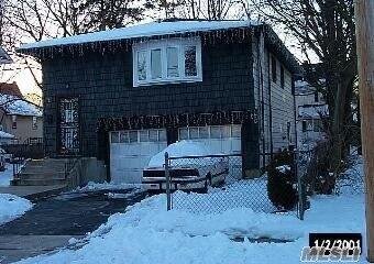
Description: 49 Shonnard Ave, Freeport, NY 11520 is a Single Family Home built in 1966. This property currently has an estimated value of $485,600. According to the Freeport public records, the property at 49 Shonnard Ave, Freeport, NY 11520 has approximately 1,619 square feet, with a lot size of 5,000 square feet. Nearby schools include Columbus Avenue School and Caroline G Atkinson School.
1,619 sqft
5,000 lot size
3 beds
2 baths
Year Built: 1966
Pre-foreclosure
49 Shonnard Ave, Freeport, NY 11520
Last Updated: December 9, 2023
1
Single Family Home
Town House
Estimated Market Value EMV $ 485,600
49 Shonnard Ave
bool(false)

bool(true)

bool(true)

int(0)
Estimated Market Value EMV $ 485,600
Foreclosure History
for 49 Shonnard Ave
Lis Pendens
(380 days)
Deed Category:
Deed Category:
LP
LP
Trustee State:
Trustee State:
NY
NY
Document Page:
Document Page:
398
398
Trustee Zip:
Trustee Zip:
11590
11590
Document Book:
Document Book:
32613
32613
Trustee City:
Trustee City:
Westbury
Westbury
Recording Date:
Recording Date:
04-12-2023
04-12-2023
Case Number:
Case Number:
608875/2019
608875/2019
Trustee Phone:
Trustee Phone:
(516) 280-7675
(516) 280-7675
Parcel Number:
Parcel Number:
55-225-00-0465
55-225-00-0465
Trustee Name:
Trustee Name:
RAS BORISKIN PLLC
RAS BORISKIN PLLC
Trustee Address:
Trustee Address:
900 Merchants Concourse
900 Merchants Concourse
Defendant Name:
Defendant Name:
TERESA BYRD AS VOLUNTARY ADMINISTRATIX AND AS HEIR DISTRIBUTEE OF ESTATE OF JOEL JOHNSON AKA JOEL F
TERESA BYRD AS VOLUNTARY ADMINISTRATIX AND AS HEIR DISTRIBUTEE OF ESTATE OF JOEL JOHNSON AKA JOEL F
Plaintiff:
Plaintiff:
Deutsche Bank Natl Trust Co As Trustee For Hsi Asset Securitization Corp Trust 2006-Opt3 Mtge Pass T
Deutsche Bank Natl Trust Co As Trustee For Hsi Asset Securitization Corp Trust 2006-Opt3 Mtge Pass T
APN:
APN:
55-225---0465-0
55-225---0465-0
GET FREE CONSULTATION
Ask an Attorney about this home
GET FREE CONSULTATION
Ask an Attorney about this home
for 49 Shonnard Ave
Type
Single Family Home
Town House
49 Shonnard Ave, Freeport, NY 11520 is a Single Family Home built in 1966. This property currently has an estimated value of $485,600. According to the Freeport public records, the property at 49 Shonnard Ave, Freeport, NY 11520 has approximately 1,619 square feet, with a lot size of 5,000 square feet. Nearby schools include Columbus Avenue School and Caroline G Atkinson School.
Property facts
Bathrooms:
Bathrooms:
1
1
Year Built:
Year Built:
1966
1966
Living Area Size:
Living Area Size:
1,619
1,619
Lot Size:
Lot Size:
0.11 acres
0.11 acres
Property Type:
Property Type:
Single Family Dwelling
Single Family Dwelling
Full Baths:
Full Baths:
1
1
No. of Stories:
No. of Stories:
1
1
Front Footage:
Front Footage:
50
50
Depth Footage:
Depth Footage:
100
100
Basement Sqft:
Basement Sqft:
527
527
Heating Fuel:
Heating Fuel:
OIL
OIL
Year Built:
Year Built:
1966
1966
Living Sqft:
Living Sqft:
1,619
1,619
Land Area Sqft:
Land Area Sqft:
5,001
5,001
Style:
Style:
RANCH
RANCH
Water Type:
Water Type:
PUBLIC
PUBLIC
Sewer Type:
Sewer Type:
PUBLIC
PUBLIC
Heating Type:
Heating Type:
CENTRAL
CENTRAL
Air Conditioning:
Air Conditioning:
CENTRAL
CENTRAL
Township:
Township:
FREEPORT
FREEPORT
Exterior Wall Type:
Exterior Wall Type:
ALUMINUM/VINYL
ALUMINUM/VINYL
Garage:
Garage:
BASEMENT - 2 CAR
BASEMENT - 2 CAR
Parking:
Parking:
BASEMENT - 2 CAR GARAGE
BASEMENT - 2 CAR GARAGE
Property Type:
Property Type:
Single Family Residence
Single Family Residence
Year
Taxes
Land
Additions
Total Assessment
2021
$9,456
$121
$259
$380
2020
$6,275
$116
$248
$364
2019
$5,534
$348
$119
$467
2018
$5,325
$348
$150
$498
2016
$7,475
$348
$322
$670
2016
$7,668
$348
$322
$670
2016
$7,668
$348
$322
$670
2015
$7,044
$348
$322
$670
2014
$6,631
$348
$322
$670
2013
$6,056
$348
$388
$736
2011
$5,431
$348
$388
$736
2010
$5,257
$348
$555
$903
2010
$5,257
$348
$448
$796
2009
$4,860
$325
$527
$852
2007
$4,729
$325
$479
$804
Address
Price
Built
Beds
Baths
Sqft
Lot Size
Distance
193 Bedford Ave
Merrick, NY 11566SF
$685,000
11/30/2023
1937
5
2
1,900
+281difference
5,144
0.66 mi
1825 Stuyvesant Ave
Merrick, NY 11566SF
$740,000
03/28/2024
1957
3
2
1,302
-317
6,250
0.89 mi
250 Grand Ave
Freeport, NY 11520SF
$588,300
12/26/2023
1915
3
2
1,194
-425
6,600
0.25 mi
139 Stuyvesant Ave
Merrick, NY 11566SF
$705,000
04/19/2024
1951
4
3
1,154
-465
5,000
0.85 mi
136 Smith St
Merrick, NY 11566SF
$899,000
02/15/2024
1920
4
4
2,120
+501
5,000
0.96 mi
9 Sumner Ave
Merrick, NY 11566SF
$500,000
04/16/2024
1922
1
1
576
-1,043
5,000
0.73 mi
28 Franklin Sq
Freeport, NY 11520SF
$300,000
04/10/2024
1910
2
2
940
-679
6,372
0.73 mi
137 Woodside Ave
Freeport, NY 11520SF
$600,000
01/03/2024
1998
6
2
2,303
+684
6,250
0.78 mi
46 Delisle Ave
Roosevelt, NY 11575SF
$782,500
12/20/2023
2020
6
3
2,150
+531
6,250
0.81 mi
14 Bushwick Ave
Merrick, NY 11566SF
$475,000
03/18/2024
1934
2
1
974
-645
5,000
0.90 mi
Address
Price
Built
Beds
Baths
Sqft
Lot Size
Distance
432 Brookside Ave
Roosevelt, NY 11575SF
$679,999
163 days ago
1957
3
3
1,611
-8difference
7,840
1.77 mi
2057 Freeman Ave
Bellmore, NY 11710SF
$549,000
371 days ago
1930
3
2
1,608
-11
4,000
1.95 mi
440 Ray St
Freeport, NY 11520SF
$579,000
457 days ago
1955
3
2
1,602
-17
7,500
1.50 mi
160 Sweezy Ave
Freeport, NY 11520SF
$480,000
354 days ago
1926
2
2
1,556
-63
8,800
1.32 mi
576 S Long Beach Ave
Freeport, NY 11520SF
$649,000
344 days ago
1956
3
3
1,548
-71
6,000
1.66 mi
1529 Mattison St
North Baldwin, NY 11510SF
$640,000
386 days ago
1946
4
2
1,700
+81
5,500
1.86 mi
1855 Twain St
Baldwin, NY 11510SF
$599,000
403 days ago
1923
3
2
1,700
+81
5,000
1.79 mi
917 Thomas Ave
Baldwin, NY 11510SF
$725,000
534 days ago
1920
3
1
1,700
+81
17,001
1.98 mi
157 Sportsmans Ave
Freeport, NY 11520SF
$300,000
391 days ago
1922
3
1
1,530
-89
2,500
1.23 mi
1525 Woodside Ave
North Baldwin, NY 11510SF
$659,000
105 days ago
1821
4
3
1,530
-89
5,084
1.95 mi
Estimated values are not a substitute for professional expertise. Contact your RE agent for a market assessment.
School Name
Rating
Grades
Parent Rating
Distance
Freeport Christian Academy & Daycare
, Freeport , NY 11520
—
K−10
0.44 mi
Children's World Psi Montessori
, Freeport , NY 11520
—
K−3
—
0.58 mi
John W Dodd Middle School
, Freeport , NY 11520
4 / 10
7−8
0.54 mi
Columbus Avenue School
, Freeport , NY 11520
—
K−K
0.23 mi
Freeport High School
, Freeport , NY 11520
4 / 10
9−12
1.40 mi
Caroline G Atkinson School
, Freeport , NY 11520
3 / 10
5−6
0.80 mi
Flood insurance:
Recommended
Flood risks are increasing as sea levels rise and weather patterns change.
This property has a
Minimal Flood Factor
.
Please Log In
Please wait... If this message is not eventually replaced by the proper contents of the document, your PDF viewer may not be able to display this type of document.
You can upgrade to the latest version of Adobe Reader for Windows®, Mac, or Linux® by visiting
https://get.adobe.com/reader/ this link .
For more assistance with Adobe Reader visit
http://get.adobe.com/reader/ this link .
You can download this PDF-document from
here .