558 E 79th St, Brooklyn, NY 11236 Kings County Last Updated: June 5, 2023
Pre-Foreclosure: Lis Pendens, Estimated Market Value $1,304,000
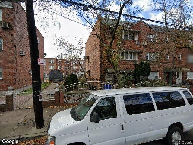
Description: 558 E 79th St, Brooklyn, NY 11236 is a Multi Family Home built in 1960. This property was last sold for $265,000 in 1990 and currently has an estimated value of $1,304,000. According to the Brooklyn public records, the property at 558 E 79th St, Brooklyn, NY 11236 has approximately 2,280 square feet, with a lot size of 3,533 square feet. Nearby schools include Explore Excel Charter School, Ps 114 Ryder Elementary School and Ps 276 Louis Marshall.
2,280 sqft
3,533 lot size
2 beds
4 baths
Year Built: 1960
Pre-foreclosure
558 E 79th St, Brooklyn, NY 11236
Last Updated: June 5, 2023
1
Multi Family Home
Estimated Market Value EMV $ 1,304,000
558 E 79th St
bool(false)

bool(true)

bool(true)

int(0)
Estimated Market Value EMV $ 1,304,000
Foreclosure History
for 558 E 79th St
for 558 E 79th St
558 E 79th St, Brooklyn, NY 11236 is a Multi Family Home built in 1960. This property was last sold for $265,000 in 1990 and currently has an estimated value of $1,304,000. According to the Brooklyn public records, the property at 558 E 79th St, Brooklyn, NY 11236 has approximately 2,280 square feet, with a lot size of 3,533 square feet. Nearby schools include Explore Excel Charter School, Ps 114 Ryder Elementary School and Ps 276 Louis Marshall.
Property features
Beds Total:
Beds Total:
2
2
Baths Full:
Baths Full:
2
2
Baths Half:
Baths Half:
2
2
Mls Area Major:
Mls Area Major:
Canarsie
Canarsie
Parcel Number:
Parcel Number:
079570046
079570046
Zoning:
Zoning:
RESID
RESID
Building Class:
B1
Two Family Dwellings: Brick
Floors on Main Building:
3.00
Building Dimensions:
20.33'
Actual Square Footage:
2,280
Calculated Square Footage:
2,318
Residential Floor Area:
2,280
Basement:
Below grade full basement
Address:
558 EAST 79 STREET
BIN
Name 558 EAST 79 STREET
Land Use:
01
One & Two Family Buildings
Lot Dimensions:
35.33'
Calculated Lot Perimeter:
271.56 ft
Zoning Districts:
R5B
Lower-density residence district
Max Residential FAR:
1.35
Max Residential Sqft:
4,770
Buildable Residential Sqft:
2,490
Residential Area Distribution:
Assessed Land Value:
$20,400
Assessed Total Value:
$58,020
Exempt Total Value:
$1,400
Last Recording Date:
Jan 8, 2024
Property Assessment Data:
Tax Class:
1
One- to three-unit residential properties
Taxable Assessed Value:
$36,976
Estimated Market Value by NYC DOF :
$910,000
Community District (CD):
318
City Council District:
46
Document DateDocument Type Unit Amount
Date
Event
Price
Price/Sqft
Source
Jul 29, 2011
Listing removed
$249,000
—
Brooklyn
Aug 18, 2010
Listed
$249,000
—
Brooklyn
Jun 19, 1990
Sold
$265,000
$116
Public Record
Year
Taxes
Land
Additions
Total Assessment
2022
$7,316
$20,400
$35,340
$55,740
2021
$7,266
$20,400
$26,820
$47,220
2020
$6,879
$20,400
$19,800
$40,200
2019
$6,397
$20,400
$11,580
$31,980
2018
$7,224
$17,998
$17,999
$35,997
2017
$6,623
$20,400
$13,560
$33,960
2016
$7,017
$18,711
$17,941
$36,652
2015
$6,452
$16,530
$18,049
$34,579
2014
$5,945
$16,202
$16,422
$32,624
2013
$5,935
$15,813
$16,673
$32,486
2012
$5,318
$16,454
$14,372
$30,826
2010
$4,647
$17,100
$13,444
$30,544
2009
$4,409
$18,576
$10,240
$28,816
2007
$3,765
$5,096
$20,593
$25,689
Address
Price
Built
Beds
Baths
Sqft
Lot Size
Distance
612 E 54th St
Brooklyn, NY 11203MF
$1,335,000
01/16/2024
—
5
6
2,295
+15difference
1,810
0.51 mi
941 E 46th St
Brooklyn, NY 11203MF
$789,000
04/03/2024
1945
4
2
2,096
-184
3,000
0.74 mi
1384 Remsen Ave
Brooklyn, NY 11236MF
$925,000
11/16/2023
1960
5
3
2,650
+370
1,900
0.86 mi
1139 E 86th St
Brooklyn, NY 11236MF
$875,000
03/11/2024
1950
4
3
1,892
-388
2,150
0.80 mi
5704 Avenue H
Brooklyn, NY 11234MF
$815,000
03/18/2024
1945
4
3
1,880
-400
1,900
0.41 mi
8424 Glenwood Rd
Brooklyn, NY 11236MF
$680,000
03/06/2024
1920
3
3
1,800
-480
2,000
0.38 mi
978 E 81st St
Brooklyn, NY 11236MF
$1,175,000
04/10/2024
1975
8
5
2,760
+480
2,000
0.48 mi
614 E 54th St Unit Townhouse
Brooklyn, NY 11203MF
$1,290,000
11/01/2023
—
5
5
3,400
+1,120
—
0.51 mi
1082 E 54th St
Brooklyn, NY 11234MF
$795,000
11/09/2023
—
3
2
1,571
-709
2,000
0.58 mi
1030 E 86th St
Brooklyn, NY 11236MF
$999,999
02/22/2024
2000
6
4
3,160
+880
4,833
0.65 mi
Address
Price
Built
Beds
Baths
Sqft
Lot Size
Distance
6911 Avenue Y
Brooklyn, NY 11234SF
$799,000
393 days ago
1970
3
3
2,279
-1difference
2,650
1.96 mi
87 E 38th St
Brooklyn, NY 11203SF
$735,000
197 days ago
1945
2
2
2,242
-38
2,242
1.70 mi
1342 E 69th St
Brooklyn, NY 11234SF
$829,000
10 hours ago
2005
3
3
2,235
-45
2,703
1.14 mi
4115 Hubbard
East Flatbush, NY 11203MF
$2,999,000
92 days ago
1910
3
1
2,220
-60
24,157
1.25 mi
7511 Avenue X
Brooklyn, NY 11234SF
$879,000
82 days ago
1935
3
3
2,200
-80
4,000
1.80 mi
2439 E 70th St
Brooklyn, NY 11234SF
$989,000
42 days ago
1975
3
3
2,172
-108
2,475
1.92 mi
40 Stephens Ct
Brooklyn, NY 11226SF
$1,350,000
72 days ago
—
3
4
2,100
-180
—
1.90 mi
7216 Avenue X
Brooklyn, NY 11234SF
$1,079,000
51 days ago
1970
3
2
2,100
-180
4,000
1.85 mi
5430 Kings Hwy
Brooklyn, NY 11203SF
$598,000
3 days ago
1945
3
2
2,093
-187
2,024
0.43 mi
5430 Kings Hwy
Brooklyn, NY 11203SF
$598,000
3 days ago
1945
3
2
2,093
-187
2,024
0.43 mi
Estimated values are not a substitute for professional expertise. Contact your RE agent for a market assessment.
School Name
Rating
Grades
Parent Rating
Distance
The Bible Speaks Academy
, Brooklyn , NY 11203
—
3−9
—
0.45 mi
Nazareth Regional High School
, Brooklyn , NY 11203
—
9−12
—
0.41 mi
Explore Excel Charter School
, Brooklyn , NY 11236
6 / 10
K−8
—
0.61 mi
Ps 114 Ryder Elementary School
, Brooklyn , NY 11236
8 / 10
K−5
0.61 mi
Nazareth Regional High School
, Brooklyn , NY 11203
—
9−12
0.41 mi
Ps 276 Louis Marshall
, Brooklyn , NY 11236
5 / 10
K−5
0.61 mi
Academy for Conservation and the Environment
, Brooklyn , NY 11236
5 / 10
9−12
0.37 mi
Brooklyn Community High School for Excellence and Equity
, Brooklyn , NY 11236
2 / 10
9−12
0.37 mi
Brooklyn Bridge Academy
, Brooklyn , NY 11236
1 / 10
9−12
—
0.37 mi
Is 285 Meyer Levin
, Brooklyn , NY 11203
7 / 10
6−8
0.62 mi
FEMA Zone (Est.)
X (unshaded)
Flood insurance:
Recommended
Flood risks are increasing as sea levels rise and weather patterns change.
This property has a
Moderate Flood Factor
.
Please Log In
Please wait... If this message is not eventually replaced by the proper contents of the document, your PDF viewer may not be able to display this type of document.
You can upgrade to the latest version of Adobe Reader for Windows®, Mac, or Linux® by visiting
https://get.adobe.com/reader/ this link .
For more assistance with Adobe Reader visit
http://get.adobe.com/reader/ this link .
You can download this PDF-document from
here .