")

bool(false)

bool(true)

bool(true)

int(0)
bool(false)
bool(true)
bool(true)
int(0)
Brooklyn, NY 11215
Foreclosure History
Lis Pendens
Property details
The description and property data below may have been provided by a third party, the homeowner or public records.
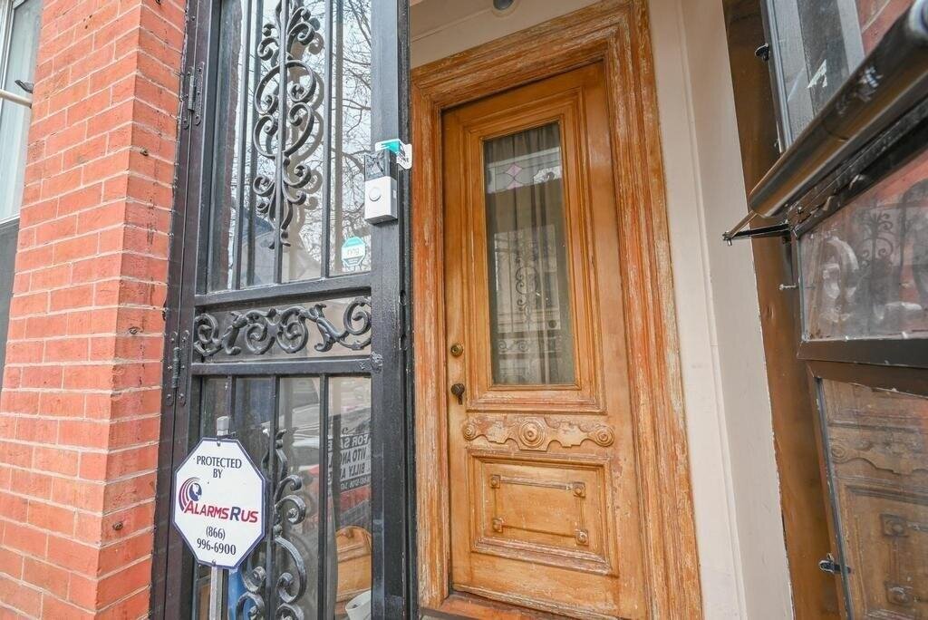
Discover this first-time offered solid brick townhome in the highly sought-after neighborhood of Park Slope, Brooklyn. Currently configured as a two-family residence, this home features a spacious one-bedroom, one-bathroom unit situated over a two-bedroom, one full + one half bathroom duplex, Which leads to a generous, ultra-private outdoor space, all positioned above a full basement. The townhome has 3, 426 unused buildable Floor Area Ratio.
Primary Land Use and Tax Lot Information
for 211 13th St

Property Price History
for 211 13th St
| Date | Event | Price | ||
|---|---|---|---|---|
| May 14, 2025 | Price Changed | $1,698,000 | $898 | Brooklyn |
| May 14, 2025 | Price Changed | $1,698,000 | $898 | MyStateMLS |
Property Tax History
for 211 13th St
| Year | Taxes | |
|---|---|---|
| 2024 | $3,875 | $133,320 |
| 2023 | $3,906 | $144,000 |
Sold Homes
near 211 13th St
| Address | Price | Beds | Baths |
|---|---|---|---|
|
Brooklyn, NY 11215MF
|
$2,200,000
05/28/2025
|
4
|
3
|
|
Brooklyn, NY 11215MF
|
$1,550,000
05/01/2025
|
4
|
3
|
|
Brooklyn, NY 11215MF
|
$2,425,000
08/15/2025
|
3
|
3
|
|
Brooklyn, NY 11215MF
|
$2,950,000
05/05/2025
|
—
|
4
|
|
Brooklyn, NY 11215MF
|
$3,050,000
06/17/2025
|
—
|
2
|
Homes For Sale
near 211 13th St
| Address | Price | Beds | Baths |
|---|---|---|---|
|
Brooklyn, NY 11231MF
|
$2,400,000
105 days ago
|
3
|
2
|
|
Brooklyn, NY 11218MF
|
$1,729,000
238 days ago
|
4
|
2
|
|
Brooklyn, NY 11215MF
|
$3,200,000
28 days ago
|
3
|
3
|
|
Brooklyn, NY 11231MF
|
$1,795,000
18 days ago
|
3
|
3
|
|
Brooklyn, NY 11231MF
|
$1,499,000
89 days ago
|
3
|
2
|
Schools
serving 211 13th St
| School Name | Rating |
|---|---|
|
552 5th Avenue, Brooklyn, NY 11215
|
— |
|
211 8th Street, Brooklyn, NY 11215
|
8 / 10 |
|
372 Clinton Avenue, Brooklyn, NY 11238
|
— |
Data provided by
GreatSchools.org © 2025. All Rights Reserved.
School service boundaries are intended to be used as reference only.
To verify enrollment eligibility for a property, contact the school directly.
Flood Factor
for 211 13th St
1
|10
Minimal

FEMA Zone (Est.)
X (unshaded)
Flood insurance:
Recommended
Flood risks are increasing as sea levels rise and weather patterns change.
This property has a
Minimal Flood Factor
.
Although flood risks across the country are changing because of the environment, this property is unlikely to flood over the next 30 years.
Although flood risks across the country are changing because of the environment, this property is unlikely to flood over the next 30 years.
Flood Factor data provided by FloodFactor.