465 Mountainview Ave, Staten Island, NY 10314 Richmond County Last Updated: February 28, 2024
Pre-Foreclosure: Lis Pendens, Estimated Market Value $1,056,400
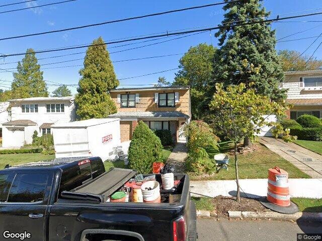
Description: 465 Mountainview Ave, Staten Island, NY 10314 is a Single Family Home built in 1970. This property was last sold for $670,000 in 2018 and currently has an estimated value of $1,056,400. According to the Staten Island public records, the property at 465 Mountainview Ave, Staten Island, NY 10314 has approximately 1,876 square feet, with a lot size of 5,200 square feet. Nearby schools include Ps 54 Charles W Leng, Ps 29 Bardwell and Ps 48 William C Wilcox.
1,876 sqft
5,200 lot size
Year Built: 1970
Pre-foreclosure
465 Mountainview Ave, Staten Island, NY 10314
Last Updated: February 28, 2024
1
Single Family Home
Town House
Estimated Market Value EMV $ 1,056,400
465 Mountainview Ave
bool(false)

bool(true)

bool(true)

int(0)
Estimated Market Value EMV $ 1,056,400
Foreclosure History
for 465 Mountainview Ave
for 465 Mountainview Ave
Type
Single Family Home
Town House
465 Mountainview Ave, Staten Island, NY 10314 is a Single Family Home built in 1970. This property was last sold for $670,000 in 2018 and currently has an estimated value of $1,056,400. According to the Staten Island public records, the property at 465 Mountainview Ave, Staten Island, NY 10314 has approximately 1,876 square feet, with a lot size of 5,200 square feet. Nearby schools include Ps 54 Charles W Leng, Ps 29 Bardwell and Ps 48 William C Wilcox.
Property features
Year Built:
Year Built:
1970
1970
Living Area:
Living Area:
1876
1876
Building Class:
A1
One Family Dwellings: Two Stories Detached (Small Or Moderate Size, With Or Without Attic)
Floors on Main Building:
2
Building Dimensions:
26'
Actual Square Footage:
1,876
Calculated Square Footage:
2,496
Residential Floor Area:
1,876
Basement:
Below grade full basement
Address:
465 MOUNTAINVIEW AVENUE
Borough:
Staten Island (5)
BIN
Name 465 MOUNTAINVIEW AVENUE
Land Use:
01
One & Two Family Buildings
Calculated Lot Perimeter:
339.01 ft
Zoning Districts:
R3X
Lower-density residence district
Max Residential FAR:
0.50
Max Residential Sqft:
2,600
Buildable Residential Sqft:
724
Residential Area Distribution:
Assessed Land Value:
$9,840
Assessed Total Value:
$48,960
Last Recording Date:
Jan 8, 2024
Property Assessment Data:
Tax Class:
1
One- to three-unit residential properties
Taxable Assessed Value:
$35,424
Estimated Market Value by NYC DOF :
$816,000
Community District (CD):
502
City Council District:
50
Document DateDocument Type Unit Amount
Date
Event
Price
Price/Sqft
Source
Jan 19, 2018
Sold
$670,000
$357
Public Record
Year
Taxes
Land
Additions
Total Assessment
2022
$6,709
$9,840
$37,620
$47,460
2021
$6,980
$9,840
$40,200
$50,040
2020
$8,571
$9,840
$35,640
$45,480
2019
$6,175
$9,840
$30,360
$40,200
2018
$5,858
$7,919
$20,089
$28,008
2017
$5,683
$9,393
$18,615
$28,008
2016
$5,500
$9,195
$18,445
$27,640
2015
$5,074
$7,366
$18,710
$26,076
2014
$4,312
$8,220
$15,120
$23,340
2014
$4,689
$8,220
$16,380
$24,600
2012
$4,797
$17,640
$8,820
$26,460
2010
$4,971
$17,217
$11,536
$28,753
2009
$4,562
$15,398
$13,355
$28,753
2007
$3,860
$4,879
$20,234
$25,113
Address
Price
Built
Beds
Baths
Sqft
Lot Size
Distance
25 Dewhurst St
Staten Island, NY 10314SF
$843,400
12/21/2023
1970
4
3
1,872
-4difference
5,000
0.77 mi
186 Martin Ave
Staten Island, NY 10314SF
$830,000
02/09/2024
1965
4
2
1,884
+8
4,000
0.93 mi
11 Waldo Pl
Staten Island, NY 10314SF
$710,000
12/15/2023
1975
3
3
2,132
+256
4,040
0.68 mi
16 Monroe Pl
Staten Island, NY 10314SF
$1,065,000
04/16/2024
1970
4
3
2,173
+297
4,100
0.10 mi
116 Mann Ave
Staten Island, NY 10314SF
$825,000
04/16/2024
2023
3
4
1,514
-362
2,493
0.86 mi
81 Brielle Ave
Staten Island, NY 10314SF
$595,000
12/08/2023
1955
4
2
1,020
-856
5,859
0.14 mi
276 Suffolk Ave
Staten Island, NY 10314SF
$600,000
03/18/2024
1965
3
2
1,000
-876
3,000
0.18 mi
197 Graves St
Staten Island, NY 10314SF
$440,000
02/19/2024
1988
2
2
1,399
-477
1,333
0.24 mi
337 Gansevoort Blvd
Staten Island, NY 10314SF
$670,000
11/15/2023
1960
4
3
1,080
-796
4,000
0.26 mi
216 Fanning St
Staten Island, NY 10314SF
$740,000
01/25/2024
1950
4
1
1,000
-876
5,040
0.40 mi
Address
Price
Built
Beds
Baths
Sqft
Lot Size
Distance
109 Caswell Ave
Staten Island, NY 10314SF
$715,000
90 days ago
1980
3
3
1,920
+44difference
2,800
1.23 mi
320 Kell Ave
Staten Island, NY 10314SF
$799,000
23 days ago
1975
3
4
1,824
-52
3,105
0.66 mi
104 Monahan Ave
Staten Island, NY 10314SF
$839,000
210 days ago
2023
3
3
1,929
+53
2,305
1.56 mi
104 Monahan Ave
Staten Island, NY 10314SF
$839,000
210 days ago
2023
3
3
1,929
+53
2,305
1.56 mi
179 College Ave
Staten Island, NY 10314SF
$699,000
58 days ago
1920
3
2
1,820
-56
3,600
1.49 mi
60 Oxholm Ave
Staten Island, NY 10301SF
$949,900
3 days ago
1960
2
2
1,820
-56
8,584
1.75 mi
25 Sumner Ave
Staten Island, NY 10314SF
$769,000
106 days ago
1920
4
2
1,815
-61
3,373
1.97 mi
253 Dubois Ave
Staten Island, NY 10310SF
$759,000
105 days ago
1920
3
3
1,943
+67
4,099
1.76 mi
43 Slayton Ave
Staten Island, NY 10314SF
$649,800
98 days ago
1988
3
3
1,944
+68
1,836
1.66 mi
559 Oder Ave
Staten Island, NY 10304SF
$829,999
75 days ago
1960
3
3
1,800
-76
2,600
1.82 mi
Estimated values are not a substitute for professional expertise. Contact your RE agent for a market assessment.
School Name
Rating
Grades
Parent Rating
Distance
Ps 54 Charles W Leng
, Staten Island , NY 10314
8 / 10
K−5
0.71 mi
Ps 29 Bardwell
, Staten Island , NY 10314
7 / 10
K−5
1.05 mi
Chabad Lubavitch of Staten Island
, Staten Island , NY 10314
—
PK−1
—
0.35 mi
Yeshiva Mesivta Menachem
, Staten Island , NY 10314
—
9−11
0.35 mi
St. Rita School
, Staten Island , NY 10314
—
K−8
0.47 mi
Is 27 Anning S Prall
, Staten Island , NY 10310
5 / 10
6−8
1.98 mi
Ps 48 William C Wilcox
, Staten Island , NY 10304
6 / 10
K−8
1.72 mi
Concord High School
, Staten Island , NY 10304
2 / 10
9−12
2.12 mi
FEMA Zone (Est.)
X (unshaded)
Flood insurance:
Recommended
Flood risks are increasing as sea levels rise and weather patterns change.
This property has a
Minimal Flood Factor
.
Please Log In
Please wait... If this message is not eventually replaced by the proper contents of the document, your PDF viewer may not be able to display this type of document.
You can upgrade to the latest version of Adobe Reader for Windows®, Mac, or Linux® by visiting
https://get.adobe.com/reader/ this link .
For more assistance with Adobe Reader visit
http://get.adobe.com/reader/ this link .
You can download this PDF-document from
here .